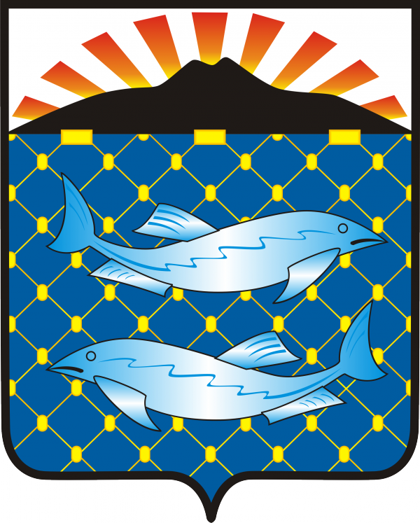
Municipal formation is located on Kunashir Island of the Great Kuril Ridge and the islands of the Lesser Kuril Ridge. The area has preserved untouched nature with unique representatives of flora and fauna, however, poor infrastructure and remoteness from civilization hinder tourism development. There are plans to attract tourists. The South Kuril District is located on an archipelago of volcanic islands. Each island is a volcano, a fragment of a volcano, or a chain of volcanoes merged at their bases. One of them is Tyatya Volcano on Kunashir Island, depicted on the coat of arms as the main landmark of the district. The red rays of the rising sun indicate that the residents of the district are among the first to greet the dawn on the territory of our country. Red symbolizes courage, beauty, and life. The yellow net and white fish signify that the leading industry of the district's economy is fishing and seafood processing. The net with floats also reflects the border location of the islands — here it serves as a kind of barrier, a cordon.
Download the vector coat of arms of the South Kuril Urban Okrug in cdr (Corel) and eps formats: gerb_Yuzhno-Kuril’skii_gorodskoi_okrug.zip
To download the raster coat of arms of the South Kuril Urban Okrug in high-resolution png format, click on the coat of arms image.
You must register to download the file
[member][maxbutton id="1" text="Download" url="/5iwT_iXNuZxgkJ" window="new" nofollow="true"][/member]
Tap to react